Best Land Surveyors in Wairarapa
Published 06 March 2025 · Updated 18 August 2026
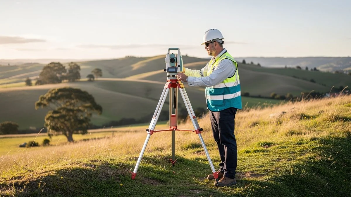
Finding the Right Land Surveyor in Wairarapa
Whether you're building a new home near Carterton, subdividing lifestyle blocks in Martinborough, or sorting out a boundary fence in Masterton, a good land surveyor is essential. They provide the accurate measurements and legal documentation that protect your property rights. Without a proper survey, you risk costly disputes with neighbours or delays with your building consent.
Wairarapa has its own quirks – from flood-prone areas to complex Māori land titles and rural boundaries that haven't been checked for decades. That's why finding a surveyor who knows the local landscape and council requirements can save you headaches down the track. Here's what you need to know to choose wisely.
What to Look for When Hiring a Land Surveyor in Wairarapa
Licensing and Registration
All land surveyors in New Zealand must be licensed under the Cadastral Survey Act 2002. Look for a surveyor who is a Licensed Cadastral Surveyor (LCS) or a surveyor working under one. You can verify their license on the Surveyor-General's register – the New Zealand Institute of Surveyors website is another good place to check.
Local Knowledge
Wairarapa councils – South Wairarapa District Council, Carterton District Council, and Masterton District Council – each have their own subdivision and building rules. A surveyor who regularly works in your district will know the local planning maps, flood hazard areas, and heritage overlays. They'll also be familiar with LINZ (Land Information New Zealand) regional data.
Experience with Your Type of Work
- Boundary surveys – for fence lines, new builds, or property disputes
- Topographic surveys – for house designs, earthworks, or drainage
- Subdivision surveys – whether you're splitting one lot into two or creating a multi-lot development
- Deposited plan or survey plan – needed for changing legal boundaries
Ask how many similar jobs they've done in your area over the last few years.
Insurance and Professional Indemnity
Check that the surveyor carries professional indemnity insurance. If a mistake is made on a survey plan – for example, an incorrect boundary mark – you'll need cover. Most reputable firms have this, but it's worth confirming.
Clear Communication
Surveyors produce technical documents. You want someone who can explain what they've found in plain English. If they're hard to reach or dismissive during the quote stage, that's a red flag.
Key Questions to Ask Before Hiring
- Are you a Licensed Cadastral Surveyor? – Only a LCS can legally complete cadastral surveys (boundary work).
- How long will the survey take? – Simple boundary pegs might take a few days; a topographic or subdivision survey can take weeks depending on the season and site access.
- What's included in your quote? – Does it cover field work, office processing, council lodgement fees, and the survey plan? Or are there extras?
- Do you have examples of similar work in Wairarapa? – Ask to see a recent subdivision plan or topographic map from the same area.
- How do you handle boundary disputes with neighbours? – If there's a disagreement over an existing fence line, your surveyor should be practised in negotiation and, if needed, providing expert evidence.
- Will I receive a digital copy of the survey? – Many surveyors now provide CAD files and PDF plans. Check if that's included.
- What happens if you find an issue? – For example, an encroachment or unregistered right-of-way. How will they communicate that to you?
Tips for Getting the Best Results
Prepare Your Paperwork
Before the surveyor arrives, gather your title, any existing survey plans, and information about previous boundary pegs. If you have old fencing or driveway agreements, dig them out. The more context you give, the faster and more accurate the survey.
Talk to Your Neighbours
A boundary survey can affect neighbouring properties. Let your neighbours know well in advance. A friendly heads-up avoids awkwardness when the surveyor starts putting pegs in. Some neighbours might even offer to split the cost if they benefit from clearer boundaries.
Check the Timing
In Wairarapa, survey work is weather dependent. Wet winters can turn rural sites into mud, and thick summer vegetation can hide boundary markers. Spring and autumn are often the best times for field work. If you're on a tight deadline (like a building consent), book your surveyor several weeks ahead.
Use the Survey Results Carefully
Once you get the survey plan, share it with your architect, builder, and council as soon as possible. A small error in the survey can lead to a big cost overrun if discovered during construction. Also, keep a copy of the plan with your property title – it's a valuable long-term record.
A Note About Costs and Getting Quotes
Land survey costs in Wairarapa vary considerably depending on the job. A simple boundary peg or re-mark might be a few hundred dollars. A full subdivision survey with multiple lots, contour mapping, and council coordination can run into thousands. Rural properties with large acreage often cost more because of travel time and access issues.
Most surveyors provide free initial quotes. It's smart to get at least three quotes for any significant job. When comparing quotes, look beyond the bottom line. A cheaper quote might skip important steps like a thorough title search or site reconnaissance. Ask each surveyor to break down their quote into parts: field work, office processing, council fees, and administration.
Also, ask about payment terms. Some firms ask for a deposit (often one-third to one-half) with the balance on completion. Others invoice after the work is done. Payment schedules should be clear from the start.
Finally, remember that a survey is an investment in your property's

The ValueHub Team built this site because finding clear, unbiased financial information in New Zealand was harder than it should be. Every guide is based on real research — we compare the actual fees, terms, and fine print so you don't have to. Our tip: shop around every year, read the policy docs, and never assume loyalty gets you the best deal.— The ValueHub Team
Try our Calculators
Use these free tools to crunch the numbers:
KiwiSaver Fund Comparison
Compare fees, returns, and risk levels across every KiwiSaver fund from all 31 NZ providers.
Currency Converter — USD to NZD
Convert US Dollars to New Zealand Dollars instantly. See the latest exchange rate and 30-day trend.
Mortgage Repayment Calculator
Calculate your weekly, fortnightly, or monthly mortgage repayments. Free NZ mortgage calculator — try different rates, terms, and repayment frequencies.
Compound Interest Calculator
See how your savings grow with compound interest over time. Free NZ compound interest calculator with yearly, monthly, and weekly compounding options.
Term Deposit Calculator
Calculate your term deposit returns before you lock in. Compare interest earned across different terms and rates with ValueHub's free calculator.
Savings Goal Calculator
Calculate how long it will take to reach your savings goal — and what monthly deposit you need to get there. Free NZ savings planner.
Land Surveyors in Other Cities
Latest Guides & Reviews
New Zealand Financial Markets Authority Guide: Investor Protection in NZ
Protect your investments with this practical guide to the FMA — how to check licences, spot scams, and what to do if a provider fails. Verified against...
comparisonEV Home Charger NZ: Costs & Buying Guide
Compare EV home charger costs in NZ — verified prices from $1,299, installation fees, smart features, and what actually matters for your home's power supply.
guideThe Most Popular EVs in New Zealand
The best-selling electric cars in New Zealand, ranked by official registration data. Top BEV and PHEV models and brands, updated monthly.
guideEV Market Stats
New Zealand's EV market in numbers — market share, fleet size, top-selling models and used imports, updated with the latest NZTA and MIA data.